Lynda – AutoCAD Civil 3D: Topographic and Boundary Survey
 2017-09-30

 2 730
2 730
 0
0
Lynda – AutoCAD Civil 3D: Topographic and Boundary Survey
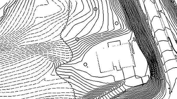
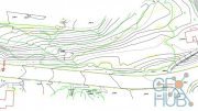
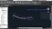
AutoCAD Civil 3D software—a design and documentation solution for civil engineering—offers tools and features that can help you maintain consistent data and improve project performance. In this course, learn how to leverage this powerful software to tackle the different types of tasks involved in a survey project, including boundary analysis and creating TIN surfaces. Instructor Dustin Manning helps you get started by explaining how to set up your survey database. He also shows how to create automated linework, draw and label boundaries, and translate surveys. To wrap up the course, he shares some helpful productivity tips.
Software used: AutoCAD Civil 3D
MP4 1280x720 | 2h 7m | ENG | Project Files | 367 MB
Download links:

Lynda - AutoCAD Civil 3D Topographic and Boundary Survey.part1.rar
Lynda - AutoCAD Civil 3D Topographic and Boundary Survey.part2.rar
Lynda - AutoCAD Civil 3D Topographic and Boundary Survey.part2.rar


Comments
Add comment
Tags
Archive
| « July 2026 » | ||||||
|---|---|---|---|---|---|---|
| Mon | Tue | Wed | Thu | Fri | Sat | Sun |
| 1 | 2 | 3 | 4 | 5 | ||
| 6 | 7 | 8 | 9 | 10 | 11 | 12 |
| 13 | 14 | 15 | 16 | 17 | 18 | 19 |
| 20 | 21 | 22 | 23 | 24 | 25 | 26 |
| 27 | 28 | 29 | 30 | 31 | ||
Vote

New Daz3D, Poser stuff


New Books, Magazines