Agisoft Metashape Professional 1.7.0 Build 11701 Win x64
 2020-12-28

 1 079
1 079
 0
0
Agisoft Metashape Professional 1.7.0 Build 11701 Multilingual Win x64
Features:
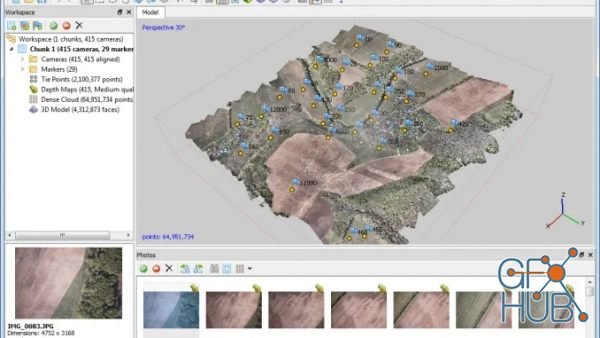
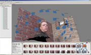
Photogrammetric triangulation
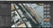
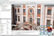
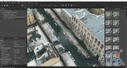
Processing of various types of imagery: aerial (nadir, oblique) & close-range.
Auto calibration: frame (incl. fisheye), spherical & cylindrical cameras.
Multi camera projects support.
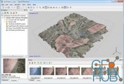
Dense point cloud: editing and classification
Elaborate model editing for accurate results.
Points classification to customize geometry reconstruction.
.LAS export to benefit from classical point data processing workflow.
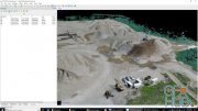
Digital elevation model: DSM/DTM export
Digital Surface and/or Digital Terrain Model — depending on the project.
Georeferncing based on EXIF meta data/flight log: GPS/GCPs data.
EPSG registry coordinate systems support: WGS84, UTM, etc.
Georeferenced orthomosaic export
Georeferenced orthomosaic: most-GIS-compatible GeoTIFF format; .KML file to be located on Google Earth.
Export in blocks for huge projects.
Color correction for homogeneous texture.
Measurements: distances, areas, volumes
Inbuilt tools to measure distances, areas and volumes.
To perform more sophisticated metric analysis Metashape products can be smoothly transferred to external tools thanks to a variety of export formats.
Download links:


Comments
Add comment

New Daz3D, Poser stuff


New Books, Magazines