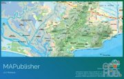
Avenza Geographic Imager v6.2 for Adobe Photoshop
 2020-10-23

 1 256
1 256
 0
0
Avenza Geographic Imager v6.2 for Adobe Photoshop
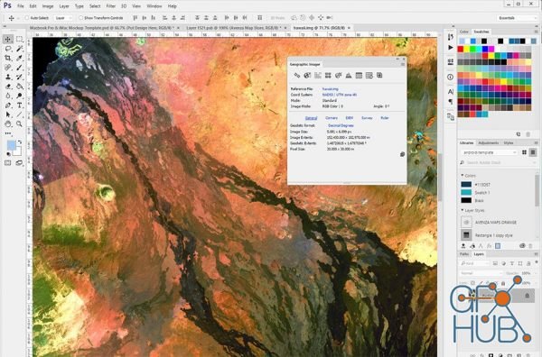
Geographic Imager® mapping software enhances Adobe Photoshop to make working with spatial imagery quick and efficient. It adds tools to import, edit, manipulate and export geospatial images such as aerial and satellite imagery. Enjoy the use of native Adobe Photoshop functions such as transparencies, filters, pixel editing, and image adjustments like brightness, contrast, and curve controls while maintaining spatial referencing.
Features:
Extensive Geospatial Image Support
Any image format that can be opened and displayed by Adobe Photoshop can form the basis for a spatial image. Import industry-used spatial images formats such as GeoTIFF, MrSID, NITF, PCI and more. Import digital elevation formats such as Esri GRID, BIL, USGS DEM and more.
True Spatial-Awareness
Georeference images easily by adding control points and assigning world coordinates interactively. Review residual errors and detect coordinate system to reference and rectify images. Manually add control points, import or export points from a text file, and view accuracy and errors. Use the Quick Georeference option to make georeferencing even easier.
Accurate Map Projections
Extensive support for thousands of geographic and projected coordinate systems. Easily transform between geodetic and projected coordinate systems. Need to define your own coordinate system? Create one or edit an existing definition and save it for future use. Manage custom transformations in an easy to use coordinate system browser.
Mosaic Like a Pro
Snapping images together not working? Mosaic individual images to create a seamless image. Mosaicked images retain spatial referencing and can be individually modified using Adobe Photoshop tools and transformed using Geographic Imager.
Tile Faster Than Saying “Tile”
Tile an image into multiple images by tile size or count and automatically save them using sequential naming. Image tiles retain spatial referencing making it ideal to import into MAPublisher and other third-party applications without any trouble.
Dynamically Control DEM Shading
Import DEM formats such as BIL, USGS DEM, Esri GRID, Military Elevation Data/DTED, SRTM and more. Assign a DEM Schema during import for easier rendering and create shaded relief maps quickly and easily using the Terrain Shader feature. Control intensity and lighting source. Define elevation intervals for custom colour ramps.
Export, Share, Use
Save spatial images to many industry-standard formats including GeoTIFF and MrSID. Export to web tiles to generate images that are compatible with Google Maps, OpenStreetMap, MapBox and more. Quick Save feature allows you to quickly save to popular geospatial formats including geospatial PDF. See a complete list of supported formats.
Minimum system requirements:
Adobe Photoshop CS6 / 2020 / 2021
2 GHz or faster Intel Pentium 4 processor (Intel Core 2 Duo or better recommended)
Windows 7 or 10 (compatible with 64-bit versions)
4 GB RAM (8 GB or higher recommended)
300 MB of available hard-disk space for installation
DVD-ROM drive (for DVD version)
1024×768 display (1280×800 recommended)
Download links:

Comments
Add comment
Tags
Archive
| « July 2026 » | ||||||
|---|---|---|---|---|---|---|
| Mon | Tue | Wed | Thu | Fri | Sat | Sun |
| 1 | 2 | 3 | 4 | 5 | ||
| 6 | 7 | 8 | 9 | 10 | 11 | 12 |
| 13 | 14 | 15 | 16 | 17 | 18 | 19 |
| 20 | 21 | 22 | 23 | 24 | 25 | 26 |
| 27 | 28 | 29 | 30 | 31 | ||
Vote

New Daz3D, Poser stuff


New Books, Magazines